Drawing with Satellites #2

In 2003 a term emerged to encompass technologies and processes that promised to reconfigure our understanding and experiences of space and culture, this term was ‘locative media’. The terminology framed a particular aspect of mobile media and signaled a shift toward a convergence of temporal and cartographic representations of space. Locative media is now synonymous for the cultural and artistic production of location based services for the IT and marketing world. Both terms stress the relevance of location, context and context awareness in interaction design and in mass market products of communication.
Technically speaking, locative media are enabled by global or local information and telecommunication systems such as GPS, GSM, bluetooth, wi-fi, rfid, etc. The aim of these technologies is to locate and track people, objects or digital information with a relative or absolute geographical position enabling “new ways of engaging in the world and mapping its own domain”, simultaneously linking actual and digital space, two perspectives in time transforming the perception of both domains.
Nicholas Nova (2004), in one of the first literature reviews on this subject, stated that two components are core to locative media: the physical environment and the social. From the urban space of cities its cultures, histories, its everyday flows, places identified with latitude and longitude coordinates, to people with their emotions, thoughts, feelings, social interactions. Contemporary artistic practices (geotagging, geoannotating, geocaching, gps drawing etc) explore and trigger these interactions revealing new ways of approaching and understanding space and everyday experience in a hybrid ecosystem, the awareness between people and their environment.
Elevating the discussion and experience over the layer of latitude and longitude coordinates is the critical focus of contemporary locative media practices, reaffirming the relationship between art and everyday life, reconstructing social and cultural spaces , investigating the implication of new imaging and cartographies techniques on our sense of place.
This, the second Drawing with Satellites workshop extends a platform for architect students to use locative media to explore the representation of the city. Nine years on since the emergence of the term locative media, GPS is now part of 60% of the mobile phones that the students have in the pockets. And for the first time, only one additional device was required to support the groups in their mapping activities. The brief didn’t alter from last year, following an introductory lecture and a test drawing, groups of students were asked to develop a conceptual starting point for a drawing, develop the appropriate method and the carry out the drawing.
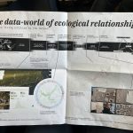
This years collection of GPS drawings extend the exploration of space, place and people through a series of playful enquiries using a wide range of methods and strategies. From mapping routes across Edinburgh that avoid CCTV camera surveillance, to finding paths that avoid crowds of people, and the routes that tourists and city dwellers take highlight was a particular interest in the street being the subject of control and consumption. Two groups identified opportunities to transform our interpretation of the GPS line by, in one case, using the postal service to send the tracker to a destination in the city, and in another using a heart monitor to generate a graphic representation of the physical activity of walking the Old and New Towns.

Gaming strategies remained popular with city being used as Monopoly board, as well as the process of navigation being informed by Chinese Whispers. The close connection between the ludic and rule based approaches to the projects informed a demonstration of the falability of the technology as one group walked the same route with multiple devices.

A further dimension to projects this year included aspects of memory, literature and storytelling. From mapping individual attachment to locations across the city, to inventing geographies for Alexander McCall Smith’s fictional book 44 Scotland Street, projects developed emotional topographies of boredom, fear and childhood.

The last drawing Fakers is also a very interesting piece because it is wasn’t made by walking the city, but by amending the GPX code to elude to travelling much further than they actually did. The first demonstration of hacking for this community of students, the work signals a shift in understanding that digital drawings are tied to computer code and not the body.

The book can be bought from Blurb here
Or you can download a PDF version (2.4MB) from here
Chris Speed, ESALA, April 2012.
References:
Nova, N. (2004). “Locative Media : a literature review.” Online article http://wiki.commres.org/pds/Project_7eNrf2010/Locative%20Media-a%20literature%20review.pdf
Related posts
Data Otherwise
Data Otherwise: More-than-Human Data Practices at DRS 2026 What if the problem with data isn’t...
DRS 2026 summary and list of RMIT papers
I’ve been fortunate to be at DRS 2026 in Edinburgh this week, about to catch a train and then...
Making Knowledge, Fragmenting Certainty
Friday 22nd, 2026 at Monash, design researchers presented artifacts from their practice—Jon McCormac...
YOU ARE NOT FEEDSTOCK
Last week at The Capitol Melbourne, we launched the RMIT Regenerative Futures Institute. I want to t...
What Doesn’t Need To Be New: Two Launches, One Week, One Paradox
Last week brought two events exploring regenerative futures from very different angles. On one after...
What does it mean for a university to be alive?
The RSA (The royal society for arts, manufactures and commerce), RMIT’s Regenerative Futures I...
Launching RFI…!
Universities are extraordinarily good at adding things. Sustainability offices. Innovation hubs. Int...
Three provocations on designing futures worth watching / reflecting…
Over recent weeks, we’ve been hosting talks from visitors who come through Melbourne. Always fun to...
What Would It Take to Read the Label?
February’s Futures Collider at RFI put three provocations in a room and asked people to act ou...
What Gets Counted When Institutions Choose Speed
Two Sessions at FACT 2026 Reflections on qualitative knowledge, AI efficiency pressures, and what ge...
Two Rooms, Two Temporalities
Two events at RMIT over the past couple of weeks revisited the temporal challenges at the heart of h...

Temporal Traps
Ending the year between collapse and care: three December gatherings on time, action, and giving bac...

Notes toward the 6th finger
I’ve spent 20 years watching designers optimise products that score well environmentally while...

Rep / Non-Rep & Foreclosure
Catching up with things, and the first of two posts this week, reflecting on events last week. Stayi...
“This communication is not for you.”
Looking to connect 2 recent events / conversations (as is my want) this time to explore a fundamenta...

Design Frequencies: Sharing International Practice in Design Research
Already deep into semester two here. Last semester School of Design RMIT College of Design and Socia...