Temporal Tactics for Mr. Seel’s Garden
Time to blog on The Memories of Mr. Seel’s Garden AHRC Connected Communities project…
Many of the projects that I get involved in highlight the stress that network media is placing upon a processional model of time in which the present day is somehow at the edge of time, and all that has gone before falls neatly in to a chronological line behind it. Network technologies are disrupting any ability to keep this line intact, as ghosts, memories and stories continue to ‘jump the line’ and come back to the present. The TOTeM project was very effective at keeping the past present within touching distance, and the Walking Through Time project literally critiqued the Google image of the present by offering overlays of an old Edinburgh.
The Memories of Mr. Seel’s Garden is particularly interesting because it had a specific temporal focus – identify a subject in which time was vividly distorted across place and community. The subject for the project was food, and specifically food across Liverpool. Despite the new look to the town centre that has been offered by the large shopping experience Liverpool ONE which combines indoor mall experiences with re-modelled surrounding streets, it is impossible for Liverpool to disguise it’s food heritage. The scale of the warehouses, it’s quick access to the docks and the extraordinary sized mansions that circle the city centre, all give clues to the amount of food that flowed in and out of the port city. Whilst the modern image of the city is perhaps represented through football and the Beatles, Michelle Bastian (PI to the project) found a ‘spectral haunting’ of the cities food heritage on the side of the new Tesco’s supermarket that sits on the edge of Liverpool ONE:
“The initial inspiration comes from a plaque commemorating ‘Mr Seel’s Garden’ which was recently erected in Liverpool. The plaque reproduces an 18th Century map, indicating that on a site now occupied by a chain supermarket, there was once a market garden. This garden, so emblematic of the kinds of local food systems that have been lost, was, however, owned by the slave trader Mr Thomas Seel. The uncanny juxtaposition of modern and historic food systems, produced by this plaque, has been commented on by a number of Liverpool local food activists, and draws together multiple elements – food, maps, history, time, power, cruelty, memory and the intertwining of the local and the global – to paint a complex picture of changing patterns of connectivity within and between communities.” taken from original proposal, Michelle Bastian.

This uncomfortable plaque sets the scene for a 12 month project that proceeded to explore the historic food systems of Liverpool and develop public engagement projects around temporality and local food. The project used a series of themes and methods through which to investigate and engage with the public, each one corresponded with the expertise of the investigators: exploring food archives (Alex Buchanan), interrogating historical maps of Liverpool (Alex Hale), and capturing oral histories from residents of Liverpool (Niamh Moore). Each investigator ran workshops to elicit material from people who lived in Liverpool and had an interest in food and it’s historical presence in the city took part to explore material and discuss any findings.
Details on each method / session and findings can be found here in the corresponding blog posts: http://www.mrseelsgarden.org/?cat=2
The project is presented through the http://www.mrseelsgarden.org website that houses the outcomes in the form of information about the project, an interactive historical map, audio stories, recipes from the archives and links to the food hacking initiatives. The website charts the development of the project, how it evolved toward its community generated content, and as the working slogan suggests it embodies the principle of ‘excavating the future of local food in Liverpool’. It’s nice to note that the graphic design for the project was led by Freddy Taylor.
Edinburgh’s work was largely centred on developing ways of engaging with the material that the workshops uncovered but to do so with a critical eye that dealt with the spatial and temporal nature of the content. We chose two primary methods: develop an iPhone App that provided a gateway to material uncovered in the archive work and oral history sessions, and support the development of a Google map that contained all of the points of food interest that community members had uncovered by scouring the historical maps.
Mr Seels iPhone App – Hacking Food and Territorialising the Cloud
https://itunes.apple.com/gb/app/mr-seels-garden/id592339365?mt=8
![]() The Mr Seel’s iPhone App was developed by Duncan Shingleton and lets you discover how we used to grow, make and eat food across Liverpool by scanning food products from the present day.
The Mr Seel’s iPhone App was developed by Duncan Shingleton and lets you discover how we used to grow, make and eat food across Liverpool by scanning food products from the present day.
The App is the primary method through which the project actively ‘hacks’ contemporary food items and haunts them with memories of the past. The barcodes on all food packaging are linked to a Universal Product Code database that gives information on what a product is. Supermarkets use these codes to access details about a product including its price. When you scan a product with the Mr Seel’s App it links to the database of archive material and stories that were gathered by volunteer researchers that describe how food was grown, cooked and eaten in the past. Just as the local food movement is transforming the global food system, our app seeks to transform Universal Product Codes into Local Memory Codes which uncover our local food heritage.
The App works by simply scanning a barcode on any food product within the Liverpool area and a historical fact or story will be returned to your phone about how people used to grow, make and eat food in the past in Liverpool. The quotes and stories have been gathered from local people who have memories about food and from historical archives that tell us how Liverpool used to a centre of local food production.
The App extends my interest in territorial clouds that offers a critique of the concept of ubiquity that is promised by corporations who sell smart phones and suggest that you will be connected to the internet and able to reach data about anyone, anywhere, anytime. In a similar way to the Wester Hailes digital totem pole that offers a physical portal to leave digital information for local people, the Mr Seels App allows anybody with an iPhone the ability to receive historical information through the channel of a barcode upon any food product but ONLY within 20 miles of Everton, Liverpool City centre and Sudley House in Mossley Hill.
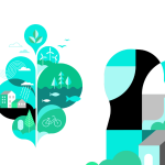
The rationale is simple, that some knowledge is meaningful because it is connected to particular contexts, and that data although fluid and liable to leak everywhere, requires architectures to retain the meaningful qualities of this knowledge. In his 2001 book Experience Design, Shedroff presents a continuum for understanding that extends from Data, through Information, to Knowledge and finally Wisdom.

Understanding Continuum, featured by Nathan Shedroff in his book Experience Design, 2001, New Riders, Indiana.
Whilst the writings pertain largely to information design it does seem interesting how the rhetoric of much digital / network activity and writing infers that data has the ability to ‘melt in to air’ and if we have the appropriate device, we are able to access it. However not all knowledge (and possibly wisdom) can simply be evaporated into data and retain its meaning. We felt that this was particularly the case for the oral histories and archive material that was so very connected to Liverpool. Transposing the knowledge and wisdom that a resident had offered from their personal childhood experience from voice into text took us perilously close to simply offering information. Worse still if we chose to attach the information to any barcode on the planet it would seem that this information would in turn become data that was disconnected from Liverpool, the person who offered the story and the place that they grew up.

By restricting the reception of the information to Liverpool, and using the barcode as a channel with the iPhone as receiver, we hope to supplement the information with a sense of context: the streets of Liverpool, to reinstate the information to knowledge. The locational properties of the iPhone with its GPS chip, mean that the information can only be recovered within the physical area in which the words are meaningful. It is hoped that this method allows the information to return to being knowledge as it resonates with the view out of peoples windows, across housing estates that were once vegetable plots and across a city that belies its enormous vibrancy as a centre for the most exotic and massive exchange of food.
The tactic (evoking de Certeau) is intended as part of a suite of methods that I am interested that better understand the affordances of ubiquity. Adam Greenfields helpful text Everyware (2009) acknowledges the dangers of assuming that ubiquitous computing is a good thing and constructs some important tenets for developing pervasive systems. The Mr Seels App is a small contribution to negotiating the condition of ubiquity in a way that constructs a territorial cloud around the people and place in which the data has most meaning.
Digital Maps – How soon is now?
http://www.mrseelsgarden.org/maps/index.html
Chris Barker worked with Alex Hale to develop an interface for revealing the many food related buildings, companies and institutions that peppered Liverpool in the past. In this work we were keen to explore how the past could be made more present and how to evoke a sense of activity across a still map. My particular bug remains with Google maps is that they fail to extended any more complex approach to time that traditional paper maps, they allude to more layers but it’s been the work of many historians that have opened up the worm holes within maps and populated them with time.

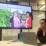
Screenshot of the map with historical map overlay plus food sites
Of critical concern since the Walking Through Time work has been the question: when is the time of the map? On smart phones it becomes very confusing, familiar with the principle that a smartphone is able to receive live news and pictures from the internet, coupled with the up-to-date pinpointing of a user’s location, it may be obvious to presume that the actual satellite imagery portrayed on the Google Map is also live. Work with folk using the Comob Net app that maps the location of friends in real-time was only going to lead to one conclusion: that if the data of our position is live, then the photographic image of the ground must also be live (Taylor 2009). For many years we have been used to paper based maps being dated as discrete editions. As access to internet based mapping tools that use satellite imagery has increased to construct local, national and international maps, we have become used to the idea that they are made up of a patchwork of images all taken at different times. Scanning quickly across the UK using Google Earth one can easily see the patchwork of colours that give clues to the different times when each photograph was taken. Upon closer inspection times vary dramatically in relatively small regions: the surrounding areas of Edinburgh appear to have been taken between three and five years ago, whilst areas of the city centre are between one and two years old. With the UK rarely experiencing completely cloudless days it is understandable that in order to provide a consistent photographic map of a large geographic area involves ‘stitching’ together a series of different images taken at different times. However as consumers have embraced the technology and the experiences associated with zooming in to anywhere on the planet, the concept of specific maps that are associated with particular times has fallen away leaving us with an uncertainty as to when a particular part of a satellite map may have been photographed. Only when we zoom into places that we are very familiar with do we realise which features are outdated – different coloured cars, landscape and architectural features, for example. This uncertainty of the age of Google Earth imagery has its consequences though, and in order to retain its place in the market as providing accurate satnav data, Google is now compelled to develop ways of providing imagery that reflects new developments on the ground. A good example of this is in their policy to release much more recent imagery for particular events that will attract a lot of people. For the 2008 Beijing Olympics, in order to aid the identification of architecture that was seen at ground level with the satellite imagery from above, Google released two-week-old imagery for the Beijing area (Taylor 2009).

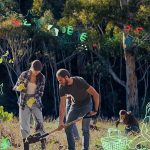
The amount of food sites across Liverpool tagged by project participants
As maps get rewritten and updated at an ever-growing pace, the temporal integrity of even the photographic satellite map begins to shift dramatically as some places are portrayed as they were five years ago, others months ago and some only weeks ago. This temporal chequer board of tiles, each reflecting a different time zone complicates further our trust in the map as flat and consistent, but instead as full of irregularities and inconsistencies. The Mr. Seel’s maps gave us an opportunity to exploit this temporal confusion and begin to describe a Liverpool that may even be still present. Through Alex Hale’s workshops community participants mapped the location of hundreds of food related establishments from pubs to markets, from orchards to piggeries. Team members tagged the location of each ‘find’ on to a Google map and Chris Barker developed an easy to use interface to display them.
Working with Alex Hale, Chris also managed to geo-reference five Ordnance Survey maps from 1891 to 1954 to provide a further context to the locations. The image of the old maps, coupled with the location of food ‘places’ transforms the city into a vibrant city in which animals, vegetables, fruits, beer and bread can be see everywhere.
Perhaps the uncanniest trick was then for Chris to visit Liverpool and walk some of the routes as though they still existed. Recorded with a GPS device, four routes take the web viewer on a tangible walk through the past from the Docks to Mr. Seel’s Garden, the Railway to Great Nelson Street Markets, from the Canal to Great Nelson Street Markets, and from the Docks to Warehousese and on to pubs. Inhabiting the maps of the past as though they were present was another method of collapsing a linear history of time and offer not just a ghost, but a human walking the past, in the present.
Other neat tricks
Time was a critical dimension to the project and as well as the App and Map we deployed a number of very interesting tactics to also challenge past, present and future as determined ‘spaces’.
Postcards
A series of postcards offered visions of Liverpool, all taken using photographs taken in 2012 by Freddy Taylor, but were coupled with captions that evoked memories of the past or activities for the future, but all opportunities for the present.

On the rear of the cards are the following captions:
Left: Liverpool was once home to over 4000 dairy cows, kept in small local dairies. Warbreck’s dairy on Prince Edwin Street in Everton featured in two of our interviews. Billie Warbreck used to deliver milk in Everton via horse and cart, using a 60 gallon churn to fill people’s own milk jugs. This dairy can also be seen on OS maps from the 1950s and 60s. Right: On the Great George Street. One of many grassed sites in Liverpool resulting from housing demolitions. This area was identified by a participant at Light Night as a possible future local food site.
The captions that accompany the present day photographs represent options for what happens next, rather than dreams of futures or lost pasts.
Food packaging
Lastly, and also playfully connected with the principle of hacking food was the decision to print a host of paper bags to be gifted to local food shops. The well made bags were emblazoned with our logo but more importantly a reference to a recipe for St. George’s Hall Cake that was found in the Liverpool School of Cookery Recipe Book (1911). The aim here is to offer a very local idea of food by offering an old recipe on a bag that contains new food, of a place that is just around the corner. Ordinary shopping bags don’t elude to a time or space, but instead to a ubiquitous supermarket brand that is everywhere, and being plastic probably for all of the time. The Mr Seels bags perish, but speak of place and a food that you can make for yourself.

The project website contains many more project initiatives that offer insights into how food can become a medium to explore temporality and community. The audio recordings of people memories provide a rich and vivid sense of Liverpool as a place in which the sights, sounds and smells of food were core to it’s very architecture.
Project Team:
Michelle Bastian (Principal Investigator), University of Manchester
Alex Hale (Co-Investigator), RCAHMS
Chris Speed (Co-Investigator), University of Edinburgh
Alexandrina Caroline Buchanan (Co-Investigator), University of Liverpool
Niamh Moore (Co-Investigator), University of Manchester
Frances Downie (Community), Community Consultant / Activist
The project was a collaboration between Transition Liverpool, Friends of Everton Park and the Friends of Sudley Estate, as well as academics from Liverpool, Manchester and Edinburgh. The main aim of the project is to explore how engaging local communities with the changing patterns of urban food production might contribute to current grassroots efforts within Liverpool to raise awareness around current food issues.
The project was funded by the Arts and Humanities Research Council and are one of ten Pilot Demonstrator Projects aimed at showcasing the distinctive approach of the new Connected Communities research theme.
References:
Greenfield, A. (2006) Everyware, The Dawning Age of Ubiquitous Computing. Berkley: New Riders
Shedroff, N. Experience Design. New Riders, Indiana. 2001
Taylor, F. (2009). About Google Earth Imagery, Web link: http://www.gearthblog.com/blog/archives/2009/03/about_google_earth_imagery_1.html
Related posts
Data Otherwise
Data Otherwise: More-than-Human Data Practices at DRS 2026 What if the problem with data isn’t...
DRS 2026 summary and list of RMIT papers
I’ve been fortunate to be at DRS 2026 in Edinburgh this week, about to catch a train and then...
Making Knowledge, Fragmenting Certainty
Friday 22nd, 2026 at Monash, design researchers presented artifacts from their practice—Jon McCormac...
YOU ARE NOT FEEDSTOCK
Last week at The Capitol Melbourne, we launched the RMIT Regenerative Futures Institute. I want to t...
What Doesn’t Need To Be New: Two Launches, One Week, One Paradox
Last week brought two events exploring regenerative futures from very different angles. On one after...
What does it mean for a university to be alive?
The RSA (The royal society for arts, manufactures and commerce), RMIT’s Regenerative Futures I...
Launching RFI…!
Universities are extraordinarily good at adding things. Sustainability offices. Innovation hubs. Int...
Three provocations on designing futures worth watching / reflecting…
Over recent weeks, we’ve been hosting talks from visitors who come through Melbourne. Always fun to...
What Would It Take to Read the Label?
February’s Futures Collider at RFI put three provocations in a room and asked people to act ou...
What Gets Counted When Institutions Choose Speed
Two Sessions at FACT 2026 Reflections on qualitative knowledge, AI efficiency pressures, and what ge...
Two Rooms, Two Temporalities
Two events at RMIT over the past couple of weeks revisited the temporal challenges at the heart of h...

Temporal Traps
Ending the year between collapse and care: three December gatherings on time, action, and giving bac...

Notes toward the 6th finger
I’ve spent 20 years watching designers optimise products that score well environmentally while...

Rep / Non-Rep & Foreclosure
Catching up with things, and the first of two posts this week, reflecting on events last week. Stayi...
“This communication is not for you.”
Looking to connect 2 recent events / conversations (as is my want) this time to explore a fundamenta...
Design Frequencies: Sharing International Practice in Design Research
Already deep into semester two here. Last semester School of Design RMIT College of Design and Socia...